Cabanatuan (Cabanatuan City)
 |
 |
The city is popular for being home to more than 30,000 motorized tricycles, making it the "Tricycle Capital of the Philippines." Its strategic location along the Cagayan Valley Road has made the city a major economic, educational, medical, entertainment, shopping, and transportation center in Nueva Ecija and nearby provinces in the region such as Tarlac, Aurora, and Bulacan. It has also earned the moniker "Gateway to the North."
Cabanatuan remained Nueva Ecija's capital until 1965 when the government created nearby Palayan City as the new provincial capital. Nueva Ecija's old capitol and other government offices are still used and maintained by the provincial administration.
After the campaign for the city's designation as a Highly Urbanized City failed, a motion was made to convert the city into a lone district instead.
Cabanatuan was founded as a Barrio of Gapan in 1750 and became a Municipality and capital of La Provincia de Nueva Ecija in 1780. Cabanatuan is the site of the historical "Plaza Lucero" and the Cabanatuan Cathedral, where General Antonio Luna was assassinated by Captain Pedro Janolino and members of the Kawit battalion. Cabanatuan lost the title of provincial capital in 1850 when the capital of Nueva Ecija was moved to San Isidro, another historic town. It was only in 1917, when the Administrative code was enacted, that Cabanatuan was restored as capital of the Province. In 1926, the historic College of the Immaculate Conception was established within the vicinity of the Cabanatuan Cathedral by the Roman Catholic Church.
During World War II, the occupying Japanese built Cabanatuan Prison Camp, where many American soldiers were imprisoned, some of whom had been forced to endure the infamous Bataan Death March. In January 1945, elements of the U.S. Army 6th Ranger Battalion and two teams of Alamo Scouts marched 30 mi behind enemy lines to rescue the prisoners in what became known as the Raid at Cabanatuan. As a result of the raid on January 30, 1945, victorious Filipino guerrillas, American troops of the U.S. Army 6th Ranger Battalion and Alamo Scouts celebrated having obtained the freedom of 500 American POWs. Soon thereafter, Philippine and American forces re-established the presence of military general headquarters and military camp bases of the Philippine Commonwealth Army, Philippine Constabulary 2nd Constabulary Regiment, and the United States Army in Cabanatuan from February 1, 1945, to June 30, 1946, during the Allied Liberation. Before long, the combined Philippine Commonwealth and American armed forces, in cooperation with local guerrilla resistance fighters and Hukbalahap Communist guerrillas, had liberated Central Luzon from Japanese Imperial forces, a campaign that lasted from January until August 1945.
In 1957, the barrios of Mataas na Kahoy, Balangkare Norte, Balangkare Sur, Sapang Kawayan, Magasawang Sampaloc, Talabutab Norte, Talabutab Sur, Platero, Belen, Pecaleon, Piñahan, Kabulihan, Pasong-Hari, Balaring, Pulong Singkamas, Panaksak, Bravo, Sapang Bato, Burol, Miller, Tila Patio, Pula, Carinay, and Acacia were separated from Cabanatuan and constituted into a separate and independent municipality known as General Mamerto Natividad.
Map - Cabanatuan (Cabanatuan City)
Map
Country - Philippines
 |
 |
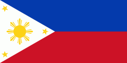
| Flag of the Philippines | |
Negritos, some of the archipelago's earliest inhabitants, were followed by successive waves of Austronesian peoples. Adoption of animism, Hinduism and Islam established island-kingdoms called Kedatuan, Rajahnates, and Sultanates. The arrival of Ferdinand Magellan, a Portuguese explorer leading a fleet for Spain, marked the beginning of Spanish colonization. In 1543, Spanish explorer Ruy López de Villalobos named the archipelago Las Islas Filipinas in honor of Philip II of Spain. Spanish settlement through Mexico, beginning in 1565, led to the Philippines becoming ruled by the Spanish Empire for more than 300 years. During this time, Catholicism became the dominant religion, and Manila became the western hub of trans-Pacific trade. In 1896, the Philippine Revolution began, which then became entwined with the 1898 Spanish–American War. Spain ceded the territory to the United States, while Filipino revolutionaries declared the First Philippine Republic. The ensuing Philippine–American War ended with the United States establishing control over the territory, which they maintained until the Japanese invasion of the islands during World War II. Following liberation, the Philippines became independent in 1946. Since then, the unitary sovereign state has often had a tumultuous experience with democracy, which included the overthrow of a decades-long dictatorship by a nonviolent revolution.
Currency / Language
| ISO | Currency | Symbol | Significant figures |
|---|---|---|---|
| PHP | Philippine peso | ₱ | 2 |
| ISO | Language |
|---|---|
| EN | English language |
| TL | Tagalog language |


